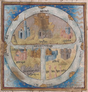
Medieval T-O World Map
Historic T-O map illustration showing a circular world divided into three continents with Latin text labels and cardinal directions in a traditional medieval cartographic style.
Bestenliste ansehen
Historic T-O map illustration showing a circular world divided into three continents with Latin text labels and cardinal directions in a traditional medieval cartographic style.
Bestenliste ansehenZieh die Teile aus dem Fach auf das Spielfeld. Bring eines nah an seinen Platz und es rastet automatisch ein.
Steckst du fest? Nutze einen Tipp, um ein Teil zu platzieren, oder wirf einen Blick auf die blasse Vorschau des fertigen Bildes.
Melde dich an, um Zeit, Züge und Sterne in deinem Profil zu speichern und in der Bestenliste aufzusteigen — komm dann zurück und schlage deine eigenen Rekorde.











