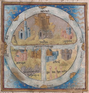
Medieval T-O World Map
Historic T-O map illustration showing a circular world divided into three continents with Latin text labels and cardinal directions in a traditional medieval cartographic style.
लीडरबोर्ड देखें
Historic T-O map illustration showing a circular world divided into three continents with Latin text labels and cardinal directions in a traditional medieval cartographic style.
लीडरबोर्ड देखेंट्रे से टुकड़ों को बोर्ड पर खींचें। किसी टुकड़े को उसकी जगह के पास लाएँ और वह अपने आप सही जगह जुड़ जाएगा।
अटक गए? किसी टुकड़े को रखने के लिए संकेत का उपयोग करें, या पूरी तस्वीर के धुंधले पूर्वावलोकन पर एक नज़र डालें।
अपना समय, चालें और सितारे अपनी प्रोफ़ाइल में सहेजने और लीडरबोर्ड पर चढ़ने के लिए साइन इन करें — फिर वापस आकर अपने ही रिकॉर्ड तोड़ें।











